
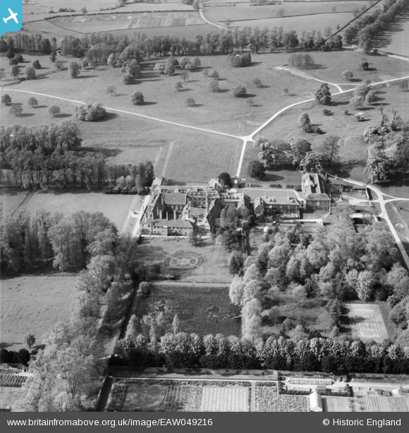
EAW049216 ENGLAND (1953). Boughton House, Boughton Park, 1953
© Copyright OpenStreetMap contributors and licensed by the OpenStreetMap Foundation. 2024. Cartography is licensed as CC BY-SA.
Nearby Images (4)
EAW049216

EAW049217

EAW049215

EAW049218

Details
| Title | [EAW049216] Boughton House, Boughton Park, 1953 |
| Reference | EAW049216 |
| Date | 11-May-1953 |
| Link | |
| Place name | BOUGHTON PARK |
| Parish | WEEKLEY |
| District | |
| Country | ENGLAND |
| Easting / Northing | 489996, 281532 |
| Longitude / Latitude | -0.67637374927138, 52.423984241926 |
| National Grid Reference | SP900815 |
Pins
 Matt Aldred edob.mattaldred.com |
Saturday 19th of March 2022 07:38:39 PM |


