


Editor’s Note: CNN’s continuing coverage of Hurricane Lee and Thursday’s forecast can be found here.
Hurricane and tropical storm watches are now in effect for much of coastal New England as Hurricane Lee threatens to deliver a blow to parts of the region as well as Atlantic Canada later this week and into the weekend.
“Hurricane conditions, heavy rainfall, and coastal flooding are possible in portions of eastern Maine on Saturday,” the National Hurricane Center said. A hurricane watch has been issued for that area, it said.
Maine Gov. Janet Mills on Wednesday urged residents to “exercise caution and to take common-sense steps to ensure they have all they need to stay safe as the storm draws closer.”
The hurricane center also warned there is potential for “life-threatening storm surge flooding” in parts of southeastern Massachusetts, including Cape Cod and Nantucket late Friday and Saturday. A storm surge watch has been issued there.
A hurricane watch has been issued from Stonington, Maine, up to the US-Canada border, as well as for parts of New Brunswick and Nova Scotia. A tropical storm watch has also been issued for a large part of coastal New England, the center added.
Lee’s winds could arrive as early as Friday evening for portions of New England and the Canadian Atlantic seaboard.
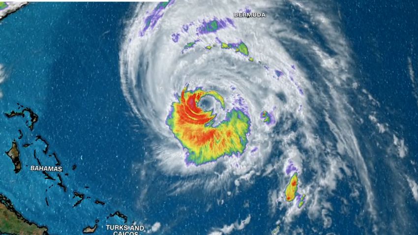
The massive storm, which remained a Category 2 hurricane Wednesday evening, was centered about 345 miles south-southwest of Bermuda, according to an 11 p.m. ET advisory from the hurricane center. The storm had maximum sustained winds of 105 mph.
A tropical storm warning remains in effect for Bermuda ahead of Lee’s brush with the island Thursday. Bermuda is expected to feel tropical storm conditions by early Thursday, the center said.
“On the forecast track, the center of Lee will pass west of Bermuda Thursday and Thursday night and then approach the coast of New England and Atlantic Canada Friday and Saturday,” it added.
Strong winds stretch out hundreds of miles from storm center
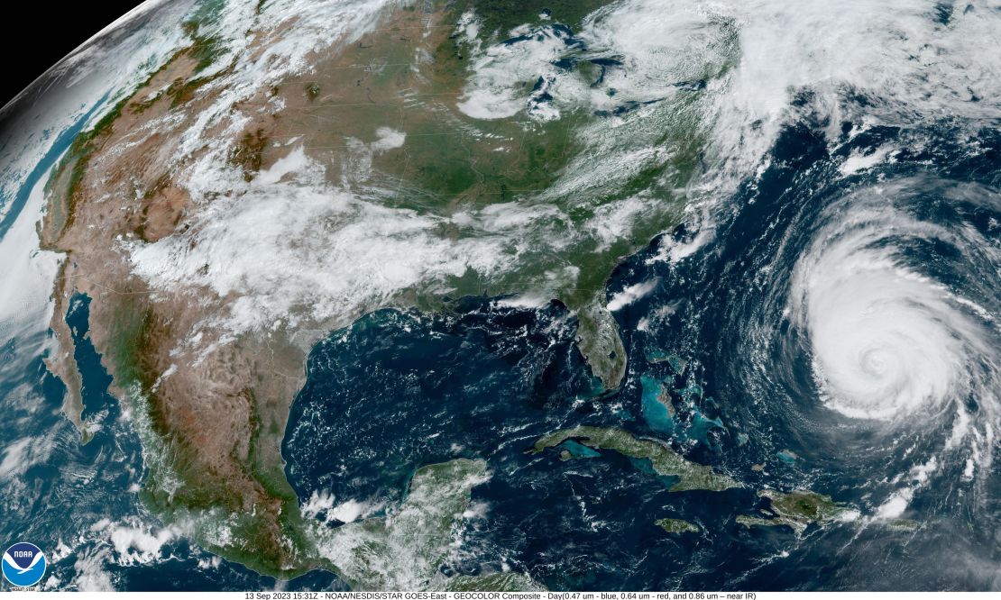
Lee will weaken, but the storm’s impacts beyond its center will be significant because of its colossal size, which has grown considerably since the weekend. Hurricane-force winds extend outward up to 115 miles from the center, and tropical storm-force winds extend out up to 265 miles.
And that’s why a weaker storm isn’t less hazardous. A larger storm carries the potential to impact a more widespread area, increasing the likelihood that Lee will affect New England. And the waterlogged region is particularly susceptible to damage from strong winds and additional rainfall.
“It’s dramatic, and I think it’s intimidating for anybody, any coastal areas that might be affected by the storm,” Lt. Cmdr. Josh Rannenberg, who is flying through Hurricane Lee, told Erin Burnett Wednesday evening. “Normally, when a major hurricane, that I’ve seen, makes landfall, a lot of the … severe damage can be relatively localized. When a storm spreads out like this, it can be intimidating in the sense that the damage is going to be much more widespread.”
Regardless of its exact track, the storm’s impacts are expected to be widespread in New England, even if it doesn’t make landfall.
“Due to Lee’s large size, hazards will extend well away from the center, and there will be little to no significance on exactly where the center reaches the coast,” the hurricane center has said.

The soil across much of New England is already soaked. Rainfall in parts of Massachusetts and New Hampshire is more than 300% above normal values over the past two weeks, according to weather service data. Destructive flooding already occurred in parts of Massachusetts earlier this week.
More rainfall this week ahead of Lee will prime the environment for flash flooding, so even moderate amounts of rain from Lee could be dangerous.
The combination of tropical storm-force wind gusts and saturated soil will also bring down trees more easily, especially since trees across New England are still in full leaf. This raises the risk of a higher number of power outages across the region.
Meanwhile, dangerous surf is affecting the southeastern US coast from Florida through the Carolinas. The risk of rip currents now spans the East Coast from Florida to coastal Massachusetts.
CNN’s Eric Zerkel contributed to this report.