
Invermallie Bothy and Glen Mallie

Inside the bothy
(Left click images to zoom in, use browser return arrow to go back)
On our 2017 Scottish trip, Chris and I (plus Border Collie ‘Mist’) had visited a couple of bothies in the course of our mountain walking (see post #223). I should add at this point that Chris has no intention of spending the night in a bothy, though the dog is certainly up for it and has spent several bothy nights out at Greg’s Hut in the Pennines (see post #141), but sometimes a walk out to a bothy gives a purpose to a day which otherwise might have been missing. Which is why, in May 2018, we were setting out to Invermallie bothy.

The route to Invermallie and back (Achnacarry marked by the red flag)

Achnacarry, Glen Mallie and Lochaber
At one level, Invermallie can’t be classed as remote as it’s 5 kms from the nearest road for the shortest walk in. However, it sits on the edge of the ‘Rough Bounds of Knoydart’, one of the UK’s last wilderness areas. I didn’t ask Chris if she fancied a 2-3 day approach walk through Knoydart to visit the bothy – some questions just don’t have to be asked. So, it was the 10 km round trip from the roadhead then.

Eas Chia-aig waterfalls and ‘the Witch’s Pool’ at the start point

A murky, misty Loch Arkaig
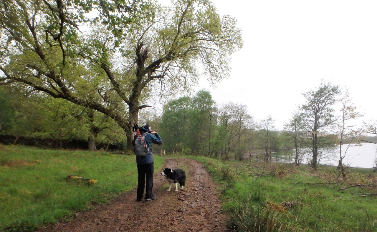
Chris and Border Collie ‘Mist’ setting out by the loch
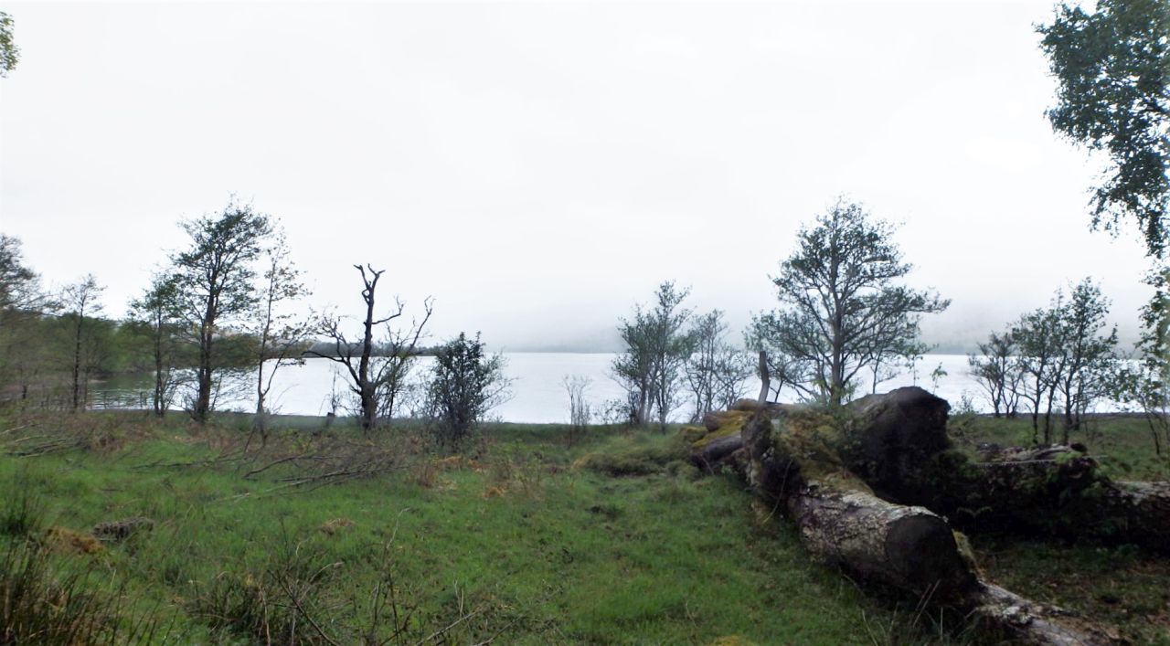
View over Loch Arkaig – still misty!
We had parked the camper up overnight near Achnacarry Castle, and woke to a misty, moisty morning. It’s a well known saying in the outdoor community that there’s no such thing as bad weather, only the wrong clothing. With a choice of waterproof jackets to go at we didn’t have that excuse, and ‘Mist’ was bouncing off the walls, keen to be setting out on her daily walk. It was time to set off to Invermallie.

The track approaching the bothy
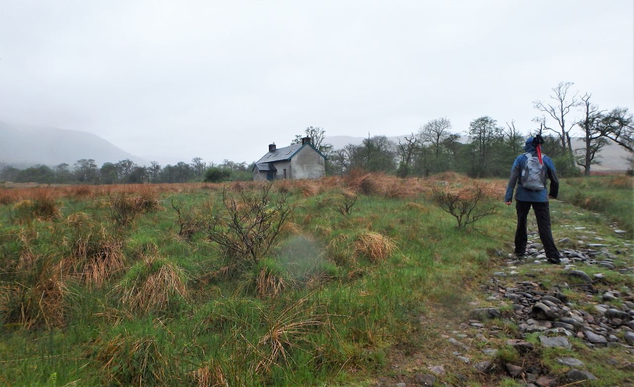
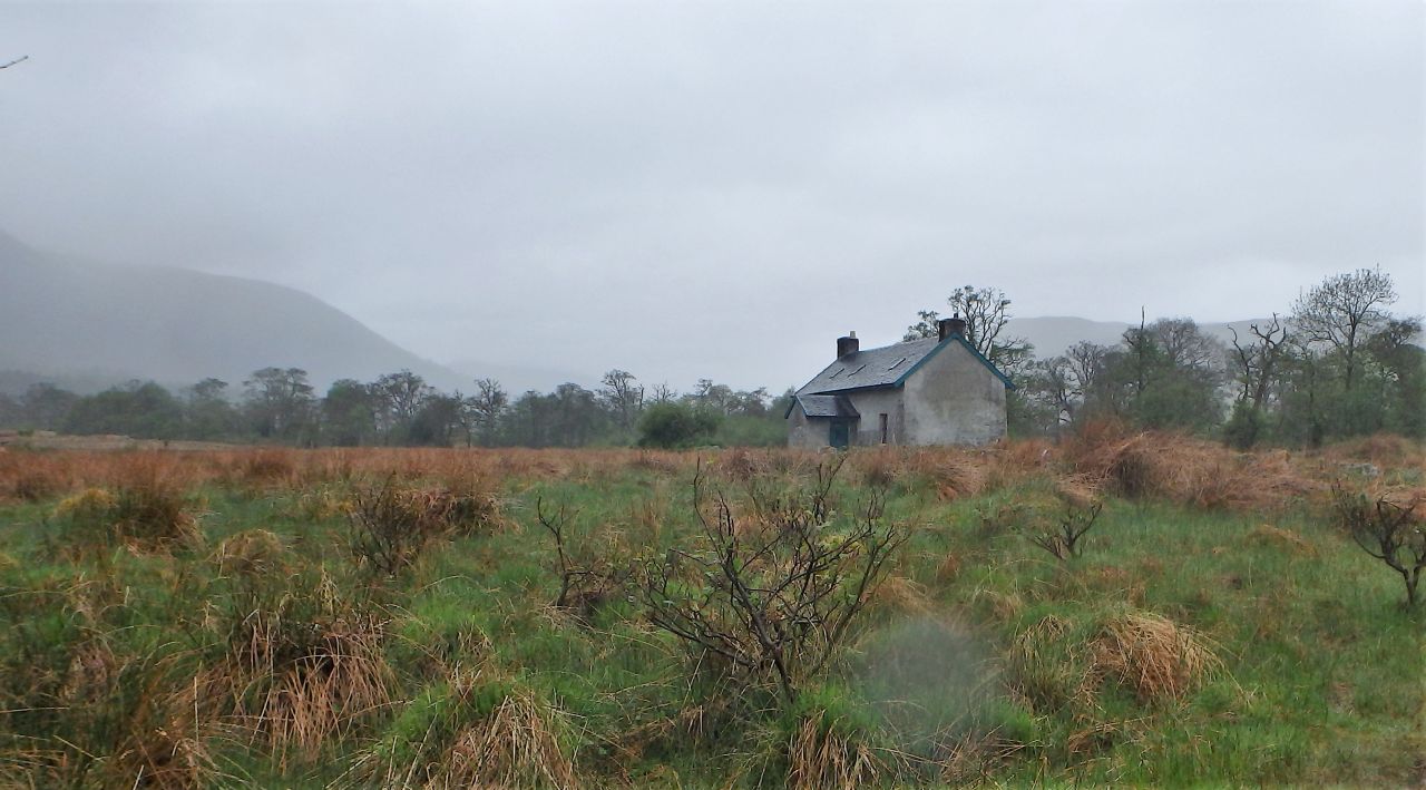
At last – the bothy
The walk out to Invermallie alongside Loch Arkaig was straightforward enough, if a little bit damp. A good track makes the route easy enough for the ‘navigationally challenged’, though I noted afterwards that the final section of the route in can sometimes be well underwater. In the event, we arrived at the bothy with dry feet.

Cooking area
Chris enjoys a hot chocolate while ‘Mist’ waits (hopefully) for a biscuit
Blog regulars will have read some of my other posts about bothy visits. The bothies are often disused workers cottages, usually in wild and remote areas – maintained on behalf of the owners by the Mountain Bothies Association, they are open for use ‘free of charge’ by anyone travelling through the mountains of the UK. The availability of the bothies, especially in Scotland, allows long trips through wilderness areas without having to carry huge amounts of camping gear – what’s not to like!

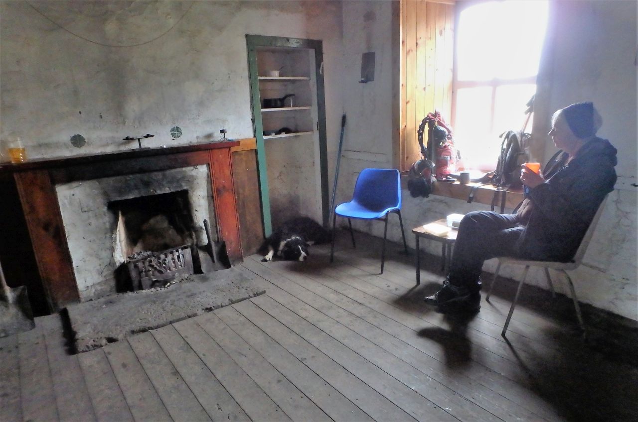
The main room with one of the ‘residents’ and a good fire going

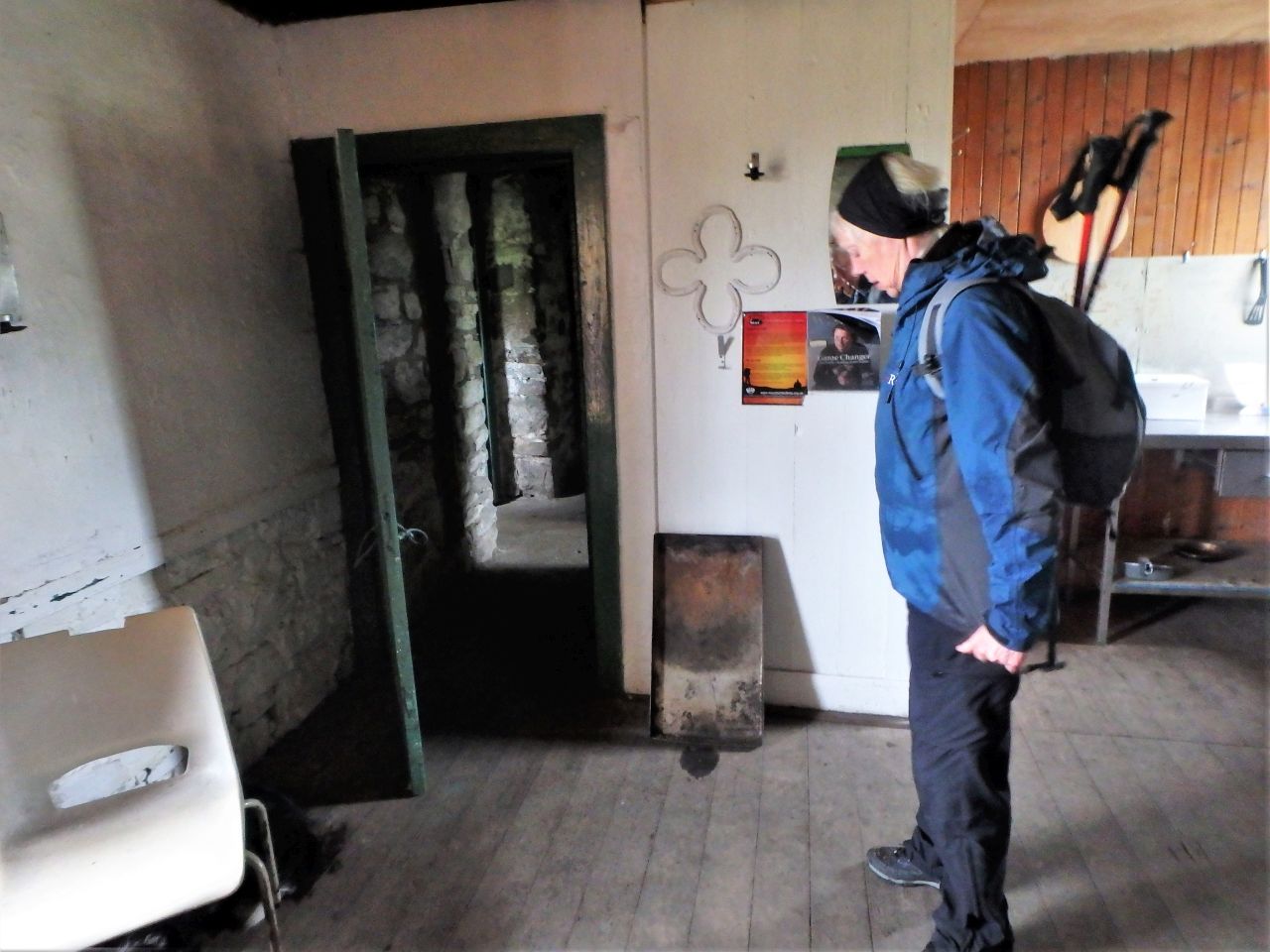
‘Mist’ inspecting one of the upstairs rooms
Ready to set out into the mist again

Heading back to the lochside

The view across Loch Arkaig looking towards the start point
One of the main downstairs rooms at Invermallie was occupied by a couple of young guys who had walked in the long way and were in the process of drying out their gear and getting a meal. We had a tour of the spacious upstairs area before getting a brew on and having lunch in the other downstairs room. Then it was time for a return through the misty wood to the parking area at Achnacarry.

The remains of the original Achnacarry Castle

New Achnacarry Castle hidden in the trees
We were due to head south the next day, but a visit to Achnacarry was part of the plan before setting off. The original lodge at Achnacarry was built in the 1650’s but was burned to the ground by English troops after the failed 1745 rebellion, and all that remains now is an ivy-covered chimney. ‘New Achnacarry’ was built in the early 1800’s but is out of bounds to the peasantry such as us, but during WW2 it became a secret military base, and the birthplace of the commandos.

Archive photo of ‘New Achnacarry’ dating back to WW2
The history of the WW2 Commandos would take much longer than a blog post to tell. In brief, the commandos were resourceful and well-trained troops, capable of not only surviving in harsh conditions but also able to fight the enemy afterwards – they were said to be ‘fit to fight and fighting fit’. The training, mostly at Achnacarry, was tough and arduous and an ascent of Ben Nevis, 18 miles away, was often the final challenge of the training.
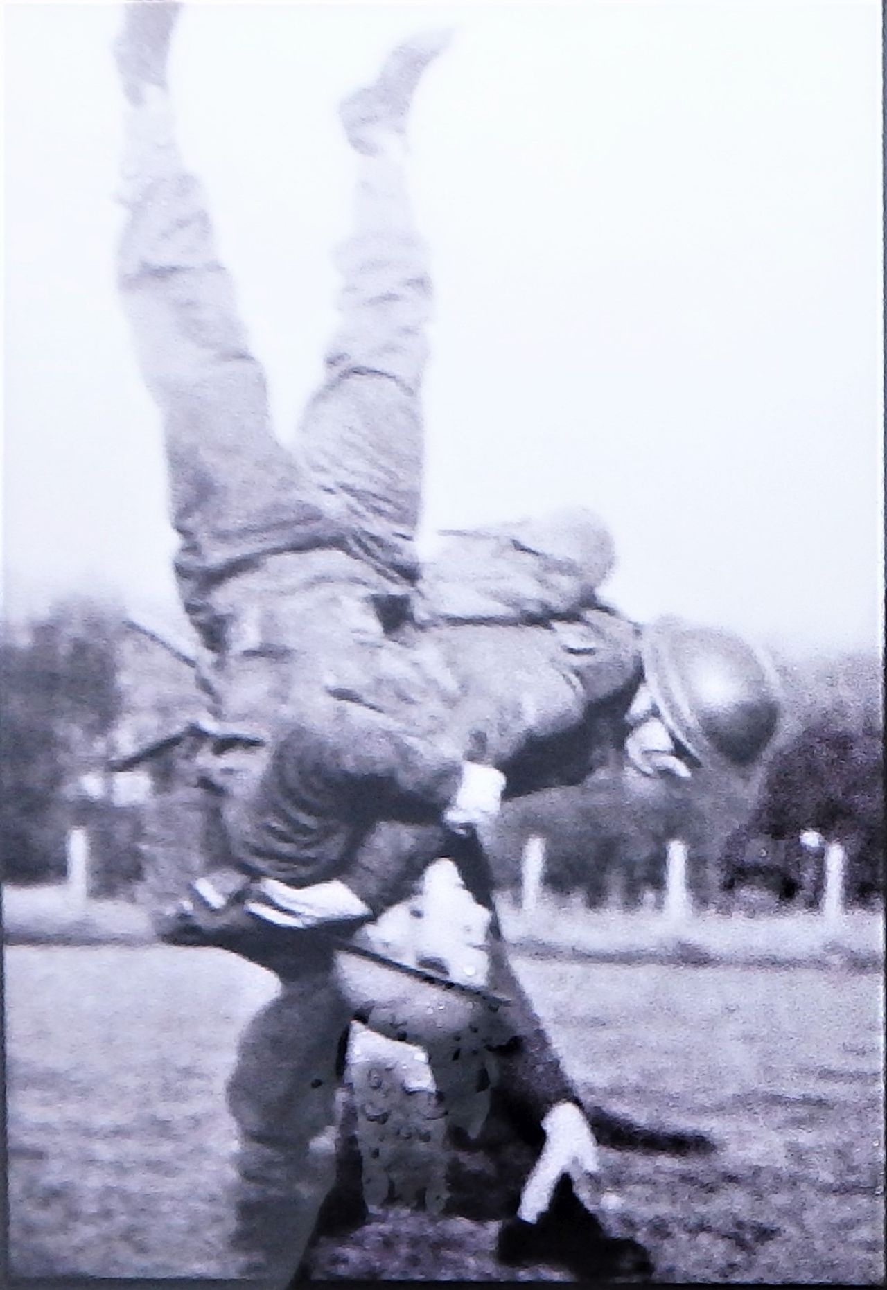
Unarmed combat

Dealing with enemy sentries

Pistol shooting
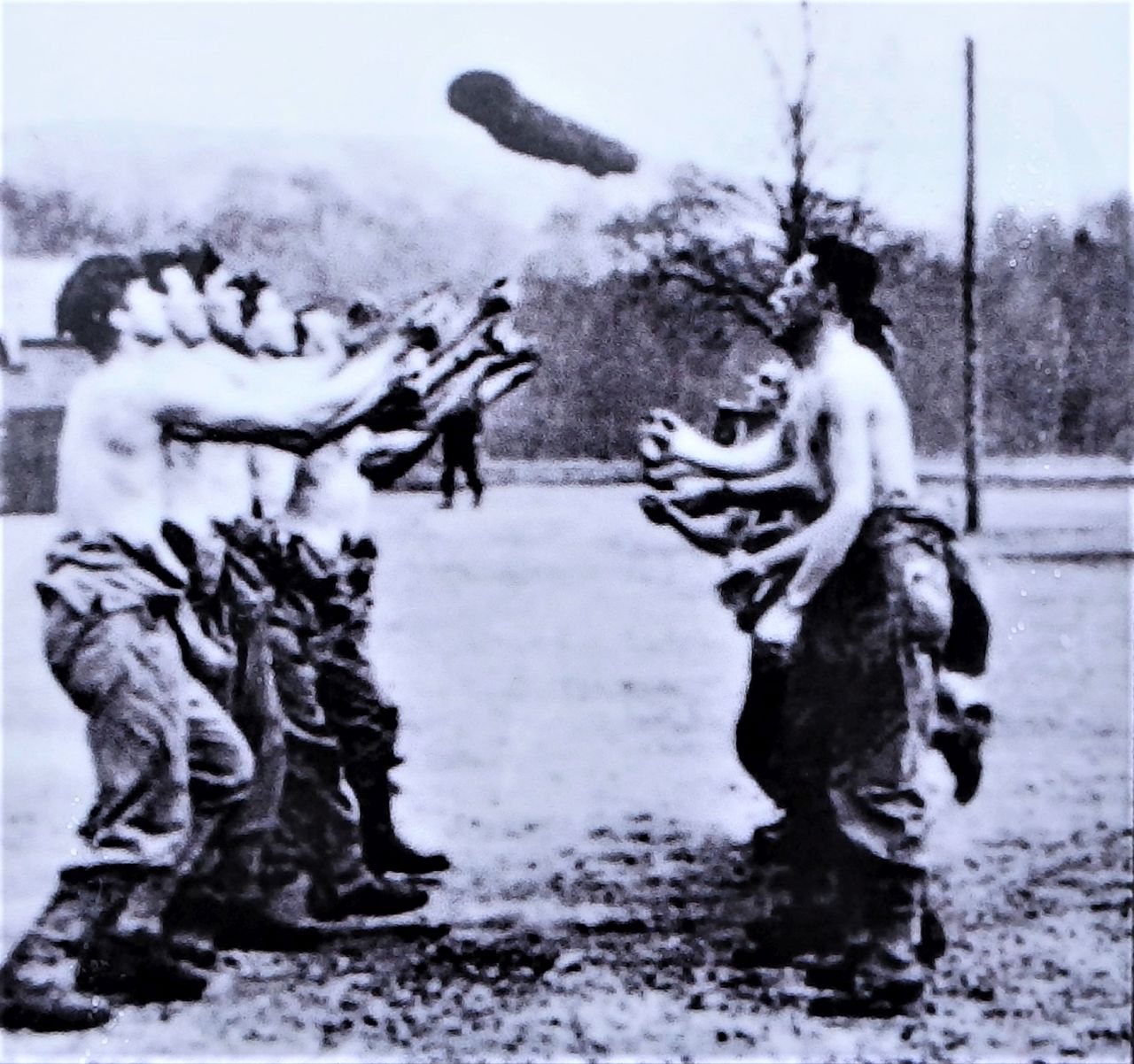
Physical training with logs

The parade ground at Achnacarry in WW2
The visit had special meaning for me as I joined the Royal Marines Commandos in 1974. Our training was similar to that of the original commandos, with an emphasis on agility and physical training, long ‘speed marches’ and the development of the commando qualities of “courage, determination, resourcefulness and cheerfulness in the face of adversity”. The training was hard, but we had the example of the wartime commandos to draw on – a fine example indeed!

Old Nissen hut at Achnacarry in May 2018, dating back to the original Commando Depot of WW2
Text and images © Paul Shorrock except the B/W images, copyright unknown.


Is that track pretty cyclable? Flattish and a decent surface? I’d like to do more bothies by bike when I’ve had my leg done…
LikeLike
The height gain is about 80 metres over 5kms, but the bothy is very near to the same level as the loch, so that 80 metres is all in ‘ups and downs’ – none are particularly steep or long and the track surface isn’t too rough, so I reckon it’s cyclable. Certainly no worse that most of your Munro trips that you used a bike on.
LikeLike
I suppose it’s not that far to walk either… hmmm
LikeLike
Pingback: #250 – Lake District bothies Part 1 – Dubbs Hut and Warnscale | Paul Shorrock – One Man's Mountains AKA One Pillock's Hillocks
Pingback: Itinerary ideas for the Fort William area - Inverskilavulin Estate Luxury Accommodation