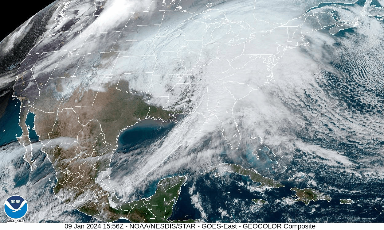
This satellite animation provides a complete snapshot of the storm encompassing much of the eastern half of the US Tuesday. The storm and its associated cold front form a distinct comma shape – a hallmark of non-tropical storms.
The storm’s center — the comma’s head — hovers over the Mississippi Valley, while its long cold front — the comma's tail — stretches from the eastern US to Mexico.
Much of the East is obscured by the storm’s thick cloud cover, making it difficult to get any peeks at the surface below. But clear skies in the Southwest reveal snow in the mountainous areas of Arizona and New Mexico.
Both states were the first to feel the storm’s impacts when it brought rain and snow to the desert on Sunday. It later moved across the central US Monday.